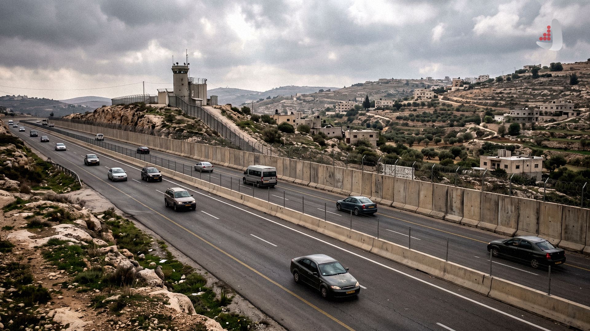
The Israeli military’s decision to reopen Route 463 to settler traffic severs Ramallah from surrounding villages and accelerates the collapse of the Oslo Accords.
According to Atlas Diplomacy, an analysis titled "Route 463: How Israel’s New Settler Road Project Isolates Ramallah" by Jessica Buxbaum has been published in The New Arab. The analysis examines how coordination between the Israeli military and settlers to seize control of West Bank transport arteries aims to isolate Palestinian urban centers and erase the political boundaries established under the Oslo Accords. Below is an abstract of the piece.
On October 9, 2026, two weeks after reports emerged that the Israeli military would reopen a section of Route 463 to settler traffic, hundreds of settlers marched between the settlements of Beit El and Dolev in celebration. The 10-kilometer highway—also known as the "Wallerstein Road" after settler movement founder Pinchas Wallerstein—was carved out without official permits in 1994 and had been closed to Israeli civilians since the start of the Second Intifada in 2000. In recent months, settlers staged demonstrations and threw stones at Palestinian vehicles under military protection, mounting heavy pressure to take over the route that ultimately won approval in principle from the Israeli army.
Passing through northern Ramallah, the road stretches from al-Bireh and the Jalazone refugee camp in the east to the village of Ein Qiniya in the west, connecting Ramallah to seven Palestinian towns, a university, a school, a major hospital, and a sewage treatment plant. According to the Palestine Liberation Organization’s Wall and Settlement Resistance Commission, opening the road to settlers isolates eight villages and two large residential neighborhoods home to tens of thousands of Palestinians from Ramallah, forcing residents onto a heavily congested route near the Jalazone camp. The erection of new checkpoints, watchtowers, and fences along the highway also heightens the risk of expulsion for nearby Bedouin communities.
Most of Route 463 lies in Area B, with smaller sections crossing through Areas A and C. Under the second Oslo Accord signed in 1995, Area A—which includes major cities such as Ramallah, where the Palestinian Authority (PA) headquarters are located—was meant to be under full Palestinian control. Splitting Ramallah and linking settlements north and east of the city with those to its west represents a decisive step toward dissolving the Oslo agreement in practice. Between 2023 and mid-2024, settlers built 139 unauthorized or new roads totaling 116 kilometers across the West Bank, and since 2024 they have established 32 settlement outposts in Area B and at least three in Area A.
These developments align with official Israeli government measures to erode the PA’s authority. Following its mass displacement campaign in the Jenin, Tulkarem, and Nur Shams refugee camps, the Israeli military established a permanent base next to the Jenin camp in Area A along with five other outposts, while the Security Cabinet granted the military’s Civil Administration enforcement powers over the environment, water, and archaeology in Areas A and B. Alongside repeated calls by Finance Minister Bezalel Smotrich to dismantle the PA and replicate the Gaza model in the West Bank, the seizure of infrastructure and highways—including Route 463 and the Beitunia bypass road (Road 4437)—is being pursued to confine Palestinians into tiny enclaves and gradually force them out of the territory./ Source